SOLUTIONS

Advanced Spatial Solutions for Complex Challenges

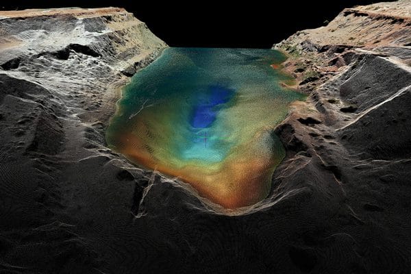
Beyond traditional surveying, Element Geospatial offers high-tech, data-driven solutions for complex spatial challenges.

Specialised Spatial Solutions

  • Environmental Analysis
    Geospatial insights for landform changes, erosion, and sustainability efforts.
  • Bathymetric Surveys
    Accurate underwater mapping for hydrographic and infrastructure projects.
  • Shaft Surveys
    Ensuring structural integrity and precision vertical alignment.
  • Geotechnical Monitoring
    Automated monitoring solutions for mine stability and hazard detection.
  • 3D Modeling & Infrastructure Scanning
    High-precision laser scanning for as-built verification and asset management.
  • Void Scanning & Inspections
    High-resolution 3D data capture of hazardous or zero-access areas.
  • Consulting, Training & Auditing
    Expert-led services to improve operational efficiency and compliance.
  • Full Turnkey Survey Solutions
    End-to-end survey setups for new mining and infrastructure projects.